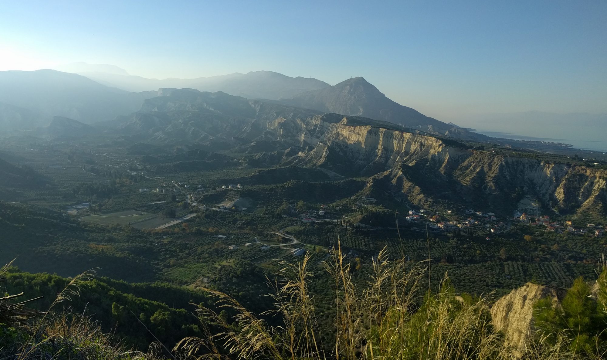

Since 2006, Professor Bob White has been operating a seismic network in the centre of the Icelandic highlands in order to understand how melt is distributed beneath the crust and hence how the crust is built. The volcano chosen is Askja, a spectacular composite volcano with 3 impressive, nested calderas. It last erupted in 1961 but its most spectacular eruption was a phreato-plininan eruption in 1875 which caused a mass exodus from NE Iceland. However, this summer, during a routine trip to download the data from the instruments it was side-lined by volcanic activity nearby.
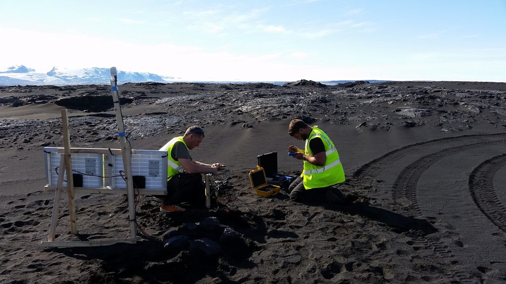
We knew as we flew out to Iceland in late August that a volcano south of Askja beneath the Vatnajökull ice sheet, called Bárðarbunga, was injecting large volumes of molten rock into a dyke that was propagating at 6 kilometres depth along the rift zone straight for Askja. Whether or not an eruption would occur was completely unknown at that time. Due to the potential risk of a glacial flood from an eruption under the glacier the field area was completely closed to the public. But as scientific researchers we had been given permission to travel into the exclusion zone. Our primary aim was to download the data from the instruments deployed around Askja over the summer. But due to an incredible piece of good fortune, fifteen spare instruments were in Reykjavik from a different project that we had been involved in, so we could deploy them around the dyke tip to collect some incredible and unique data.
When we arrived in Askja, we got straight to work deploying our extra instruments around the dyke tip, including two stations on the old lava field directly above the dyke.
Doing fieldwork in a volcanically active area is a risky activity and the safety of everyone was our primary concern. So when a magnitude 4.5 earthquake occurred less than 2 km away from the mountain hut which we were staying in, waking us all up, we decided that it would be best if we retreated out of the exclusion zone to see whether or not the activity, which was happening beneath Askja itself, would come to a stop.
After one night away, we were back. The seismic activity near our hut had died down and although the dyke was getting closer and closer to Askja and no-one wanted to be around if the dyke came into contact with evolved melt pockets in the crust close to Askja, we decided that the area was safe enough to continue our work. As we had not had the time to deploy all our extra seismometers, we quickly deployed them around the dyke tip, finishing at 2230h. After a quick dinner, we settled into bed for what should have been a pleasant night’s sleep.
After a couple of hours of sleep we were woken by shouts of an eruption happening. Like all good geologists we were dressed as quick as a flash and were driving towards the eruption site. We got closer in stages, checking for potential hazards, until we were only 2 km from the vent, although as it was dark there was no sense of scale, and we could have been 10 km or 500 m from the eruption site. The sight was incredible, the orange glow of the eruption while the aurora borealis danced overhead. The notebooks then came out and we faithfully wrote down changes in the eruptive activity until 0430h when we decided to take shifts at observation duties, allowing everyone else to get some sleep.
When we woke up after a couple of hours of sleep it turned out that the eruption had finished at about the time we had left the eruption site. The first shift had seen no changes until 0630 and the second shift had not gone out at all. We were all suitably excited at this point, but thought that this was likely to be all the activity we would see. After all, once a dyke had breached the surface, surely it would continue until the pressure was released. As the eruption had stopped surely the driving force had gone, therefore there should be no more eruptions in the near future. Given this, we thought we should get on with the job that we were here to do, that is, gather the data recorded over the summer.
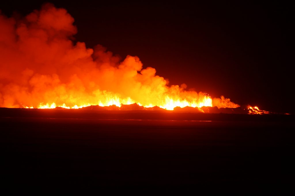
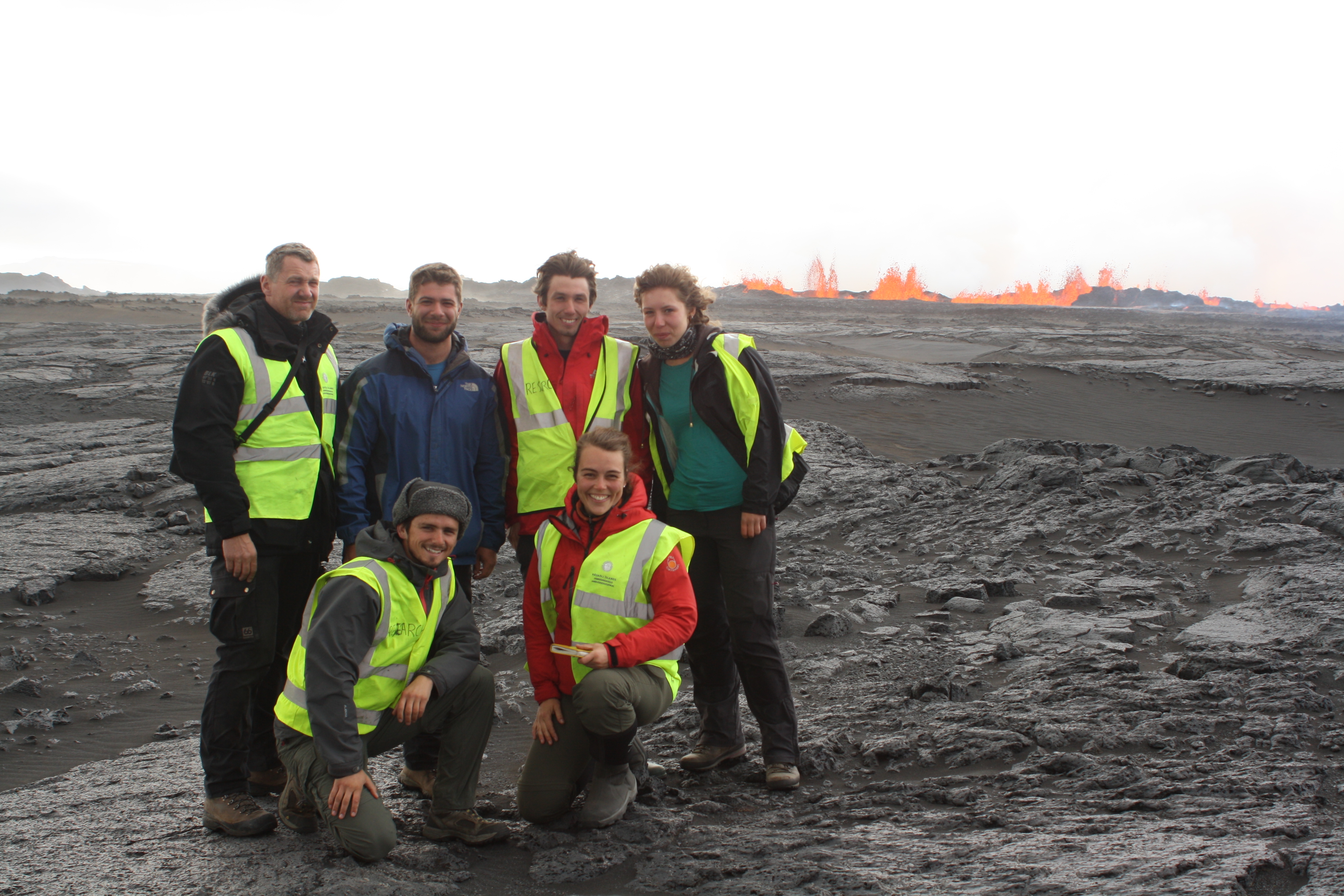
You can imagine our surprise when two nights later a similar shout occurred in the early hours of the morning exclaiming that another eruption was happening. Orange lights had been seen on a webcam and it was not a car driving across the sand plains like the evening before! As a group we ventured out into a horrible sandstorm to confirm whether or not an eruption was happening. Once we were close enough to the eruption a magnificent site awaited us – a curtain of fire 1 km long and 100-150 m high was seen and the sound was like a giant waterfall. Our Icelandic technician, suitably blasé given this was his 13th eruption, was the only person not mesmerised by it. This was quite handy, as he managed to save a seismic station from being engulfed by lava, when the lava was only 30 m away! This eruption was here to stay and formed a constant backdrop of fire fountaining while we continued collecting our data from around Askja. Watching it is a strangely surreal experience. You can lose yourself in the fountains for hours at a time, they seem to be constantly changing and yet continually doing the same thing.
While we could have stayed watching the eruption for ever, sadly the time came when we had to leave the area. The eruption is continuing as I write, producing incredible volumes of lava and sulphur. Approximately 1 cubic kilometre of lava has been erupted, covered more than 60 km2, making this the largest eruption in Iceland for 150 years. The sulphur produced has formed a noxious haze which depending on the wind direction covers almost a third of Iceland, causing breathing difficulties for those particularly at risk. It also shows no signs of stopping, producing on average 500 tons of lava per second.
Tim Greenfield MSci 2007-2011, PhD 2011-present
Photographs courtesy of Tim Greenfield, Thorbjorg Agustsdottir and Professor Simon Redfern