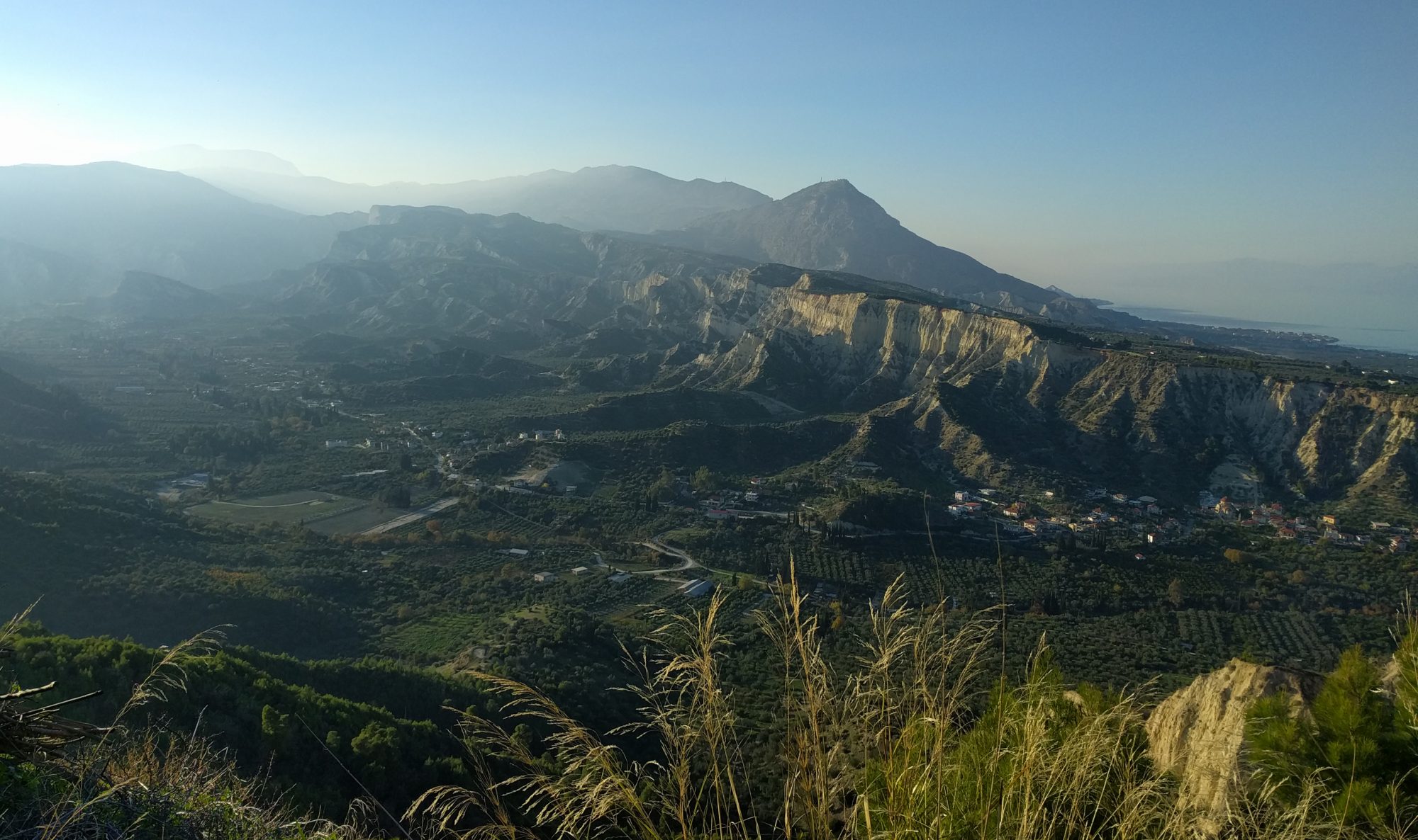
On the 9th of December, the second group (party B) of 16 part-II students set off to sunny Central Greece. This area is one of the most tectonically active regions in the world and experiences regular large (4-6 on the Richter scale) earthquakes. This relatively fast movement, together with the large amount of karstic limestone in the area, allows for evidence of vertical uplift or subsidence (e.g. on the coasts) to be well preserved and provides students with an excellent opportunity to visualize active continental extension. The aim of the trip is for students to explore, observe and then interpret earthquake focal mechanisms, surface expressions of faults (fault scarps) and vertical coastal movements.
The first three days are concentrated around the Gulf of Corinth. From our base in Loutraki, a small town on the east side of the Gulf of Corinth, we first look at an elevated Greek harbour on the Perachora peninsula. We also see plenty of Lithophaga holes above the current sea level in many localities. These are molusc borings that can be up to 20cm long, formed close to sea level. Dating the shells left behind in these holes provides us with an uplift rate by which these coastlines have risen up out of the sea. The consequences of such rapid uplift led to the catastrophic end of a small chapel, when an up to 3m high mudslide completely inundated it. The chapel has now been removed (see below).

The second day we venture up the west coast of the Gulf of Corinth and study the rate of uplift on this side. A curious observation is that the rate of uplift increases away from the Corinth canal. We also see fan deltas where many of the towns along the coast are built, and visit an exceptionally beautiful cross section of a so-called Gilbert delta. Again, this delta has been uplifted out of the ocean. The highlight of the third and final day in this region is a detailed look at the Corinth Canal – a four-mile long cut providing a fine cross-section of tilted fault blocks. The goats proved useful as a sense of scale and some good entertainment with their acrobatic hill climbing skills. At the end of the day we visit some fumaroles and hone some special skills: looking for glinting mineral phase cleavage planes in a black rock in the dark!
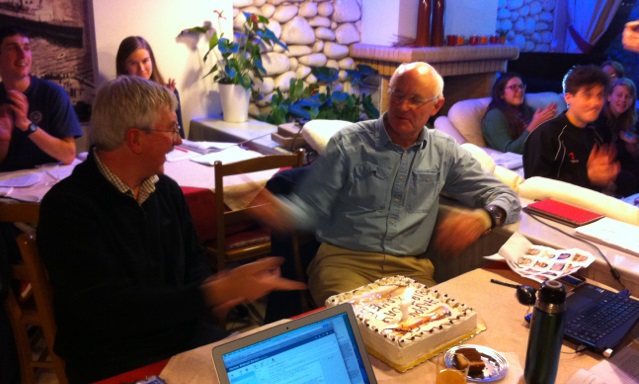
The last night in Loutraki saw us celebrating the birthdays of two of the leaders: James Jackson and Bob White, who just happen to share the same birthday!

The second half of the trip is run from a small town, Kamena Vourla, on the west coast of the Gulf of Evia. Along the way we spend some time examining a clear fault scarp left in the landscape near a small town, Platea, by an earthquake in 1981. After some students and demonstrators enjoy a nice dip in the lovely lunch spot bay, we head towards the Evia Gulf coast, taking note of a subsiding mosaic floor, travertine beds (lithified reeds), and visiting a spectacular exposed fault scarp of over 50m (and thus likely showing the movement of over 50 earthquakes!) and finally examining dark basalt rocks in the fading light.
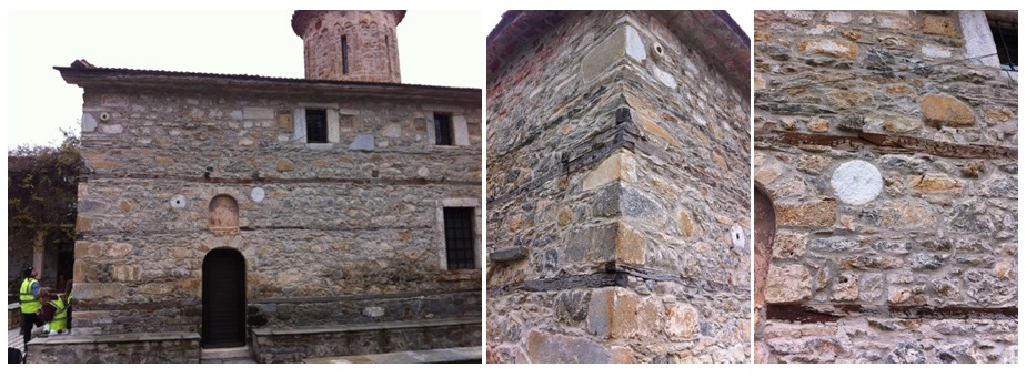
The first day after arriving in Kamena Vourla, is spent comparing the slower rate of the opening of the Gulf of Evia (compared to the Gulf of Corinth) while simultaneously admiring the formation of several birds-foot deltas to the NW of the gulf. The last two days are spent looking at the older geology of the area. After five days of Cenozoic limestone, we head to the north east and look at an older (Jurassic) ophiolite complex revealed in one hillside walk in Anvara. Along the walk we even looked at a very strange rock structure which suddenly moved, scaring myself and a couple of students. This small rock turned out to be a viper (one of only two types of snakes in Greece). The second day looking at this older geology was somewhat hampered by engine failure of one of the three vans, resulting in just the students going with the drivers, leaving the demonstrators behind. Lunch is spent at a monastery that had been destroyed in the 1980 earthquake and subsequently abandoned; a new monastery being built on the other side of the road. The chapel in the court of the older monastery, however, seems to have survived the earthquake rather well; probably helped by its construction using wooden courses in-between layers of rocks/bricks allowing for movement (see below). We spend some time looking at an interesting roadside outcrop in the thick fog, getting the students to practice their mapping skills.

The final outcrop turns out to be a bit of a surprise. Here students normally hunt for garnets in a small hardly-exposed outcrop, but due to the building of a new road, there are now hundreds of metres of new exposure. Perhaps something to look forward to next year?
Once again, the late flight out of Athens, allows us to take a route to the airport via Delphi. The weather held out for the whole trip but unfortunately the rain comes pouring down, making a visit to the museum rather than the outdoor complex a must. Here we see a rebuilt instrument, a predecessor to the organ, dating back to 1500BC – the first of its kind. The thick fog and torrential downpour continued for most of the trip to the airport, forcing us to driving at an extremely modest 50 km/hr on the motorway!
Once more, the Greece field trip proves to be a hit amongst the students. The long drive times were appreciated by dozing students and the friendly welcome by both hotels, lovely food, mostly good weather and amazing localities (both the geology and historic archeological sites) make this fieldtrip one of the favourites.
Iris Buisman Technical Officer

