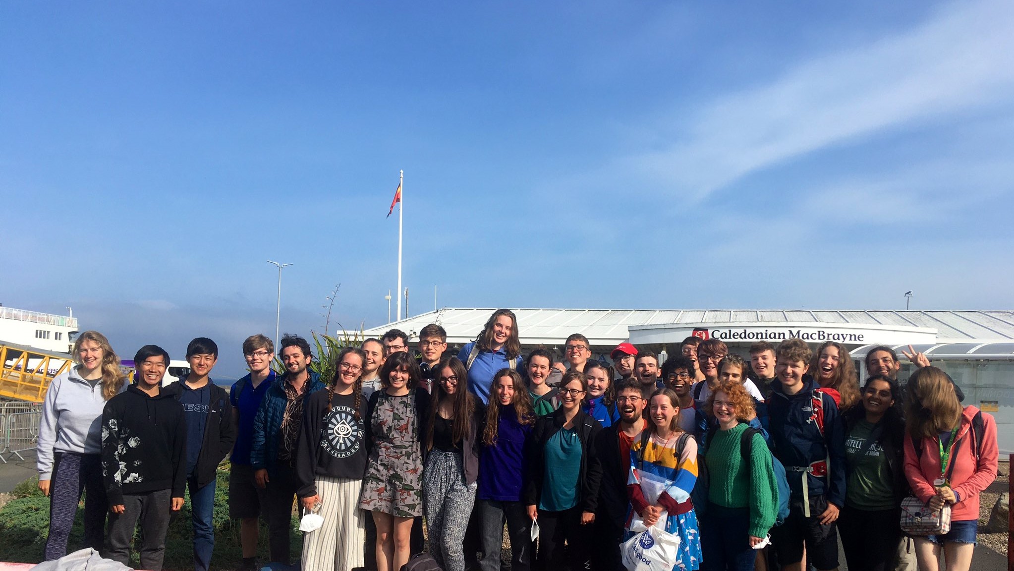
Cambridge seismology graduate named one of 2021 Top 50 Women in Engineering

Image of mountainous backdrop, with winding road extending into the distance

Grace Campbell is an earthquake geologist and remote sensing specialist in Arup‘s Natural Hazard and Risk Management Team.

After gaining a Master’s degree in Earth Sciences at UCL, Grace moved to Cambridge to study – firstly for an MPhil in Environmental Science and Remote Sensing at the Department of Geography, then moving to Earth Sciences to undertake a PhD on earthquake hazards in central Asia. 

Grace has now worked at Arup for 5 years, and was recently recognised as one of 2021’s Top 50 Women in Engineering. We caught up with Grace in the following blog post and heard more about her work on natural hazard and risk management.

Continue reading “Cambridge seismology graduate named one of 2021 Top 50 Women in Engineering”

Carrie Soderman on interning with the Environmental Audit Committee

Carrie in the lab, wearing protective gear and stood in front of a mass spectrometer

From February to April this year, in the midst of lockdown and halfway through the third year of my PhD, I took 3 months away from geochemistry to work with the Environmental Audit Committee, a House of Commons Select Committee. This opportunity was part of an amazing policy internship scheme run by UKRI, who oversee the funding of my PhD. Although not sure that I wanted to pursue a policy career, applying to the scheme seemed like a great opportunity to learn more about the career path and develop transferable skills.

Continue reading “Carrie Soderman on interning with the Environmental Audit Committee”

Life after graduating, and life before the Cambrian Explosion

Before the unprecedented months of virtual everythings – hand sanitiser-soaked fingers and meetings in pyjama bottoms – I was happily enjoying my final year as an undergraduate. Whilst making the most of my time left in beautiful Cambridge and running the greatest student geological society there is (the unofficial title I awarded the Sedgwick Club), I found myself working on an interesting Master’s project with Alex Liu. The exciting results that came out of this project gave me something to focus on whilst stuck at home in the months after graduation. I’ll tell you more about my project, and my journey to getting my results published, in this blog post.  

Continue reading “Life after graduating, and life before the Cambrian Explosion”

Masters student gets detailed snapshot of earthquake tremors in Reykjanes Peninsula, Iceland

Just hours after Dan Roberts, Masters student at Cambridge Earth Sciences, handed in his dissertation on the seismicity of Reykjanes Peninsula, Iceland, the volcano in his study area erupted… Here Dan reflects on how his work, which employs Cambridge-developed earthquake mapping software, is helping inform our understanding of seismic and volcanic hazards in Iceland.

Continue reading “Masters student gets detailed snapshot of earthquake tremors in Reykjanes Peninsula, Iceland”

Celebrating International Women’s Day 2021

Cambridge Earth Sciences is proud to be celebrating International Women’s Day on 8 March 2021. International Women’s Day has occurred for well over a century with the first gathering held in 1911. In addition to celebrating the social, economic, cultural and political achievements of women, International Women’s Day also marks a call to action for accelerating gender parity.

Continue reading “Celebrating International Women’s Day 2021”

Catherine Craston demystifies the role of a Museum Collections Assistant

The roles of museum curators and archivists are often shrouded in mystery – what do they get up to behind the scenes? In this post I lift the lid on the profession and give you an insight into my job as Sedgwick Museum’s Collections Assistant for the intriguingly named, Moving a Mountain project. But first, I’ll start at the beginning – how I first got hooked on museum collections.   

Continue reading “Catherine Craston demystifies the role of a Museum Collections Assistant”

The UK’s best student mapping project

In June every year, the Part II examiners in Cambridge Earth Sciences select the best mapping project of the year group, based on the quality of field maps and notebooks, and on the final drafted map and report. Since 2006, this top project has won the Reekie Prize within the department; a useful accolade to put on the CV. However, a yet bigger prize is then at stake. In December, the project gets submitted for a national award: the Dave Johnston prize of the Geological Society’s Tectonic Studies Group (TSG).

Continue reading “The UK’s best student mapping project”